I think the complex of springs bubbling up to form the headwaters of the Scuppernong River are some of the coolest springs in the Kettle Moraine. The Scuppernong Springs Nature Trail website has tons of great articles and information about The Springs.
The Trail and Springs sit on a 120 acre nature preserve, so you don’t have to worry about getting shot at when you hike or volunteer at this site.
I began working here back in 2003-2004, after I “finished” the Brady’s Rocks Project. I cut the buckthorn on the hillside between Hwy 67 and the trail and also did some work near the Marl Pit bridge. Then I was lured away by the challenge of the Hartland Marsh until May, 2011, when I returned to The Springs.
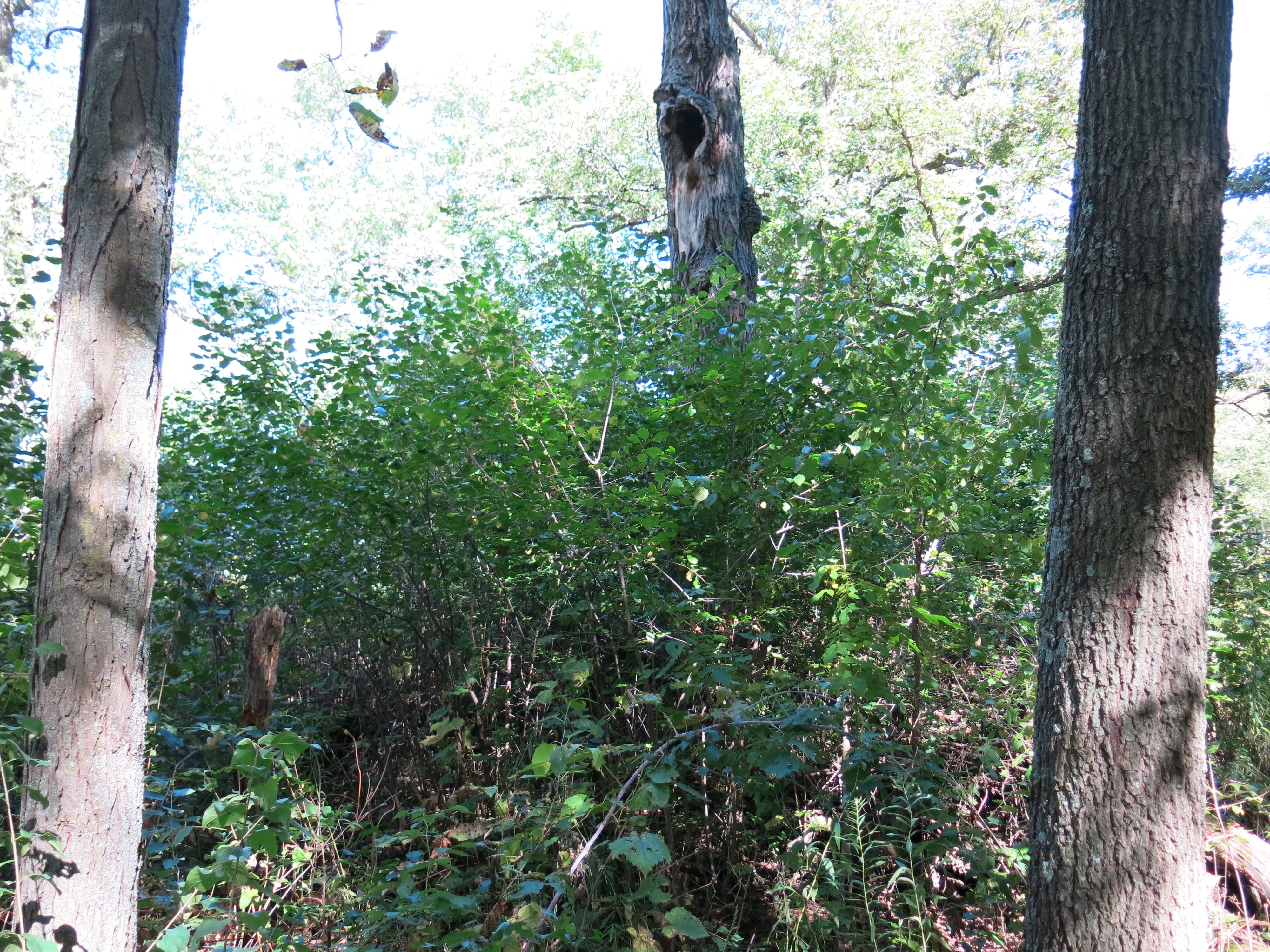
The first area I focused on was the Indian Spring, which was actually hard to even find back then. Since then, with a lot of help from my friends, we have continued to cut and burn the buckthorn and girdle the black locust and aspen, clearing a wide swath all around the trail.
We are helping the DNR rehabilitate the Scuppernong River, hopefully, all the way back to a Class I Trout Stream.
In the last couple years we have rebuilt many of the decks and boardwalks, lifting them out of the mud to allow the natural movement of water beneath them.
We have sowed native grass and flower seeds and transplanted local native plants to areas that were barren.
Ben Johnson is responsible for the birdhouses and benches!
There is still a lot of work to do at The Springs. Check out the Volunteer page to see how you can get involved.
Steve, Lindsay, Paul and Carl
Burn the Scuppernong!
The Scuppernong Spring
Southeastern Wisconsin Trout Unlimited
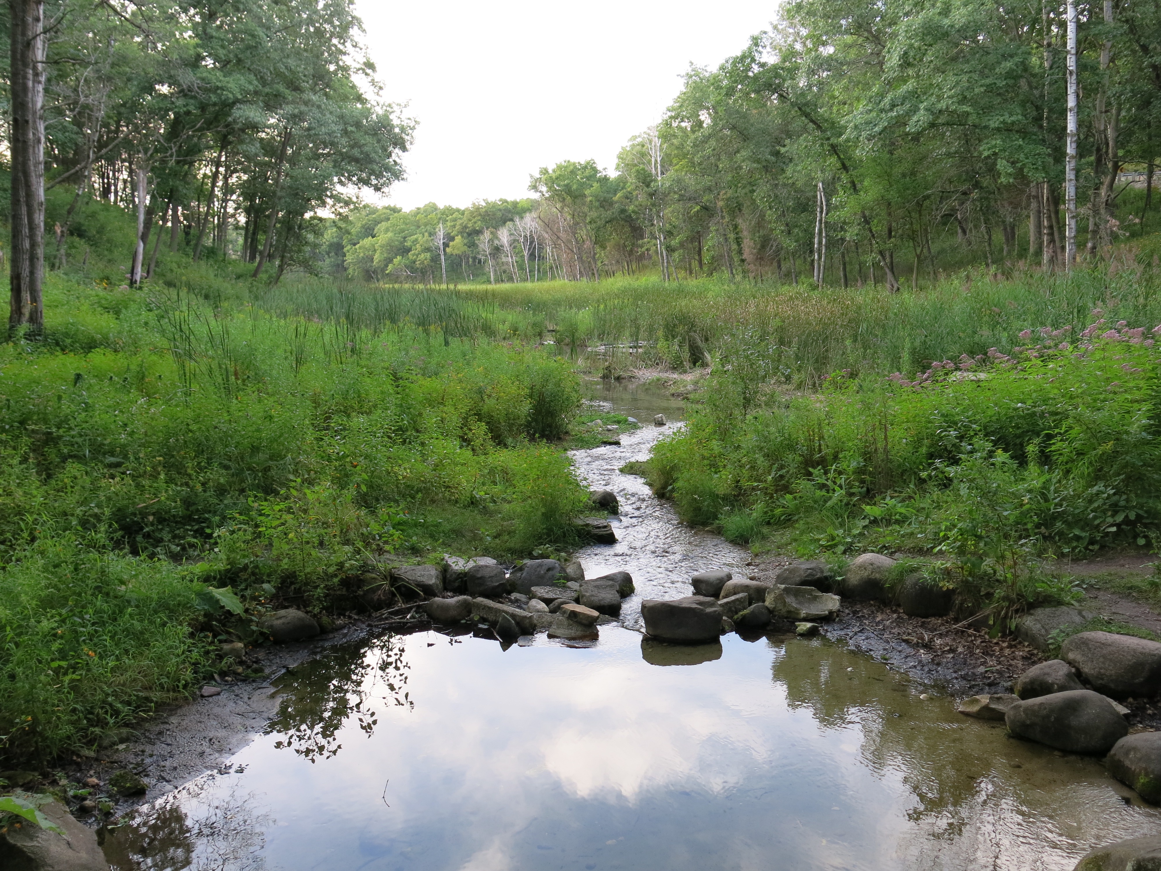
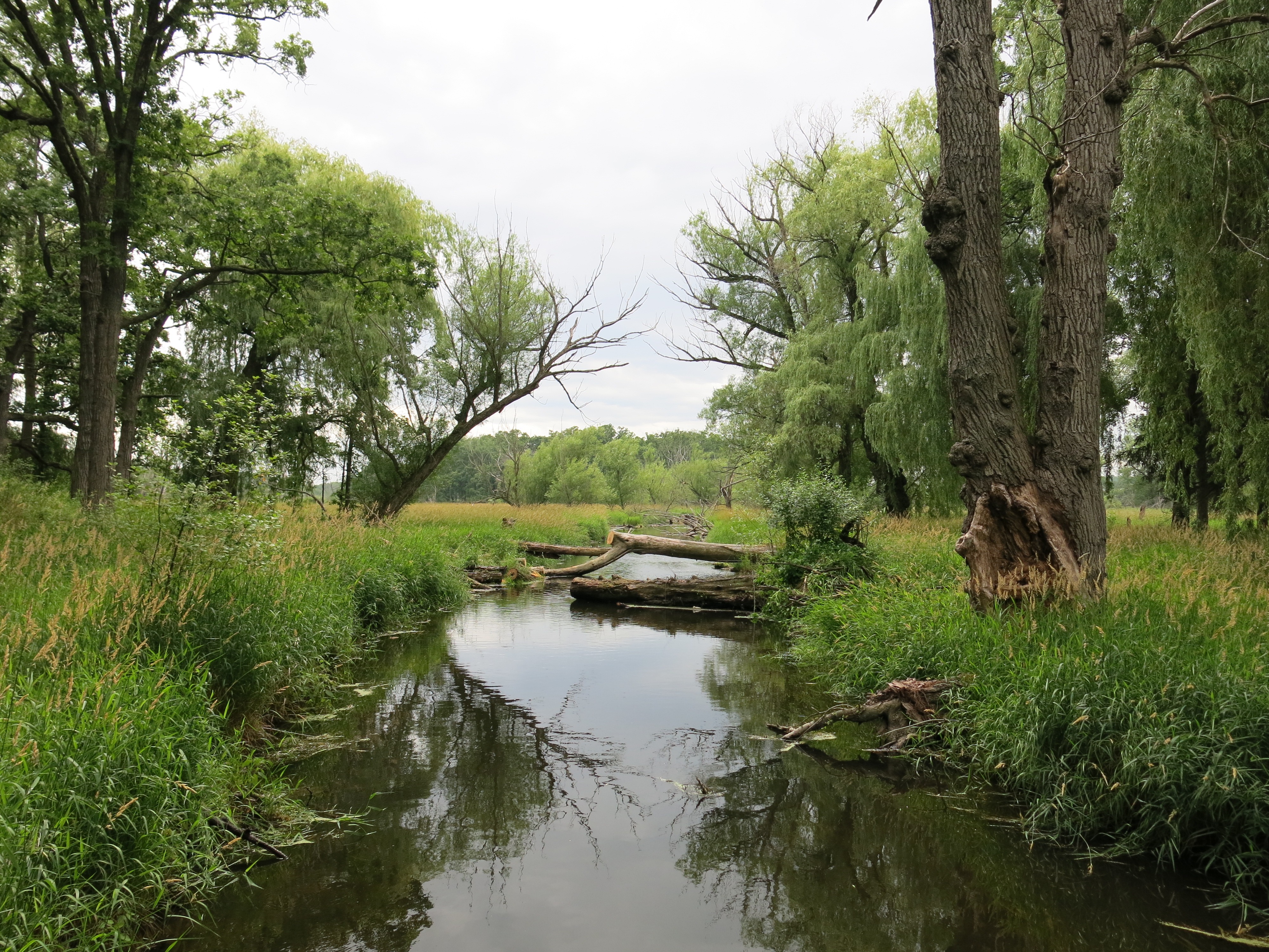
Bend in Scuppernong River
Trinity United Methodist Church
Lindsay and Paul accepting Land Steward of the Year Award
Ben Johnson uses a dolly like some people use duct tape.
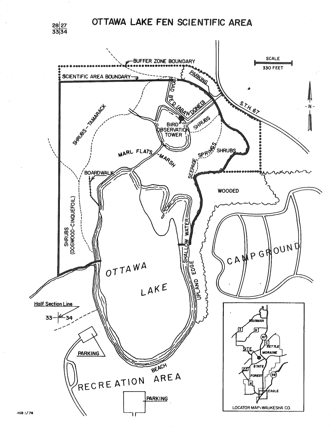
The Ottawa Lake Fen State Natural Area is one of 674 designated State Natural Areas in Wisconsin, and together they comprise 380,000 acres of some of the most beautiful and treasured lands in the state. Working at The Fen was a natural progression from working across the street at the Scuppernong Springs Nature Trail and having an eye for buckthorn.
For a comprehensive history of the area I highly recommend Robert Duerwachter’s excellent books THE PONDS OF THE SCUPPERNONG, and The Tibby Line. Pick up your copies, while they last, at the Kettle Moraine State Forest — Southern Unit headquarters because these wonderful historical references are out-of-print (Robert may have a few left). Here are some historical views of the territory.
1836 Survey Map (Ben Johnson, SEWRPC Land Survey Assistant)
1836 Survey Notes (per Ben “Here’s as far back as we’ll ever get, 1836. The Section corners that match our other maps are in red. The surveyors found marsh, brooks, and oaks. A few grassy areas. The last statement says they found grapes and other vines? I don’t think the Fen and Lake were separate entities until the canals were dug. The water level must have dropped and now we have a shallow wetland separating the two areas. Our beloved tamarack grove probably didn’t exist.”
1873 — A closer look at “Silver Lake”, which was eventually renamed to Ottawa Lake (from THE PONDS OF THE SCUPPERNONG).
The perspective circa 1892 (provided by Ben Johnson).
This 1913 map from THE PONDS OF THE SCUPPERNONG shows the route of the Tibby Line railroad from Dousman to the marl factory at The Springs.
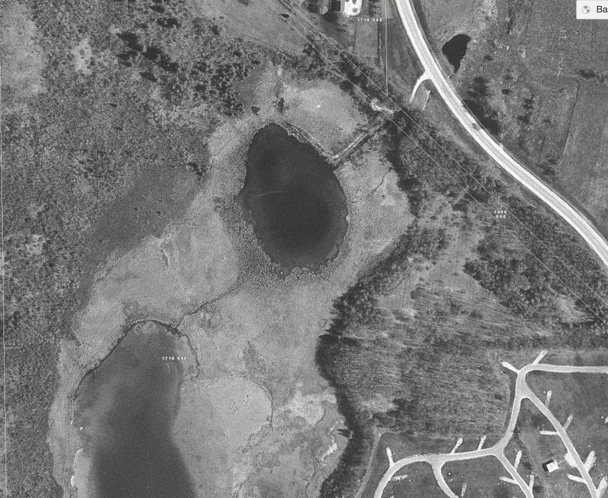
Silver Lake in 1937. Notice the different layout of drainage canals from that depicted in the map below (thanks Ben).
The Ottawa Lake Fen 1970. It is possible that the distinction between the fen and the lake was caused by the drainage canals diverting water to the south, away from the lake.
Evidence of the drainage systems created to farm the land west of Ottawa Lake and The Fen? Remember, the map is not the territory.
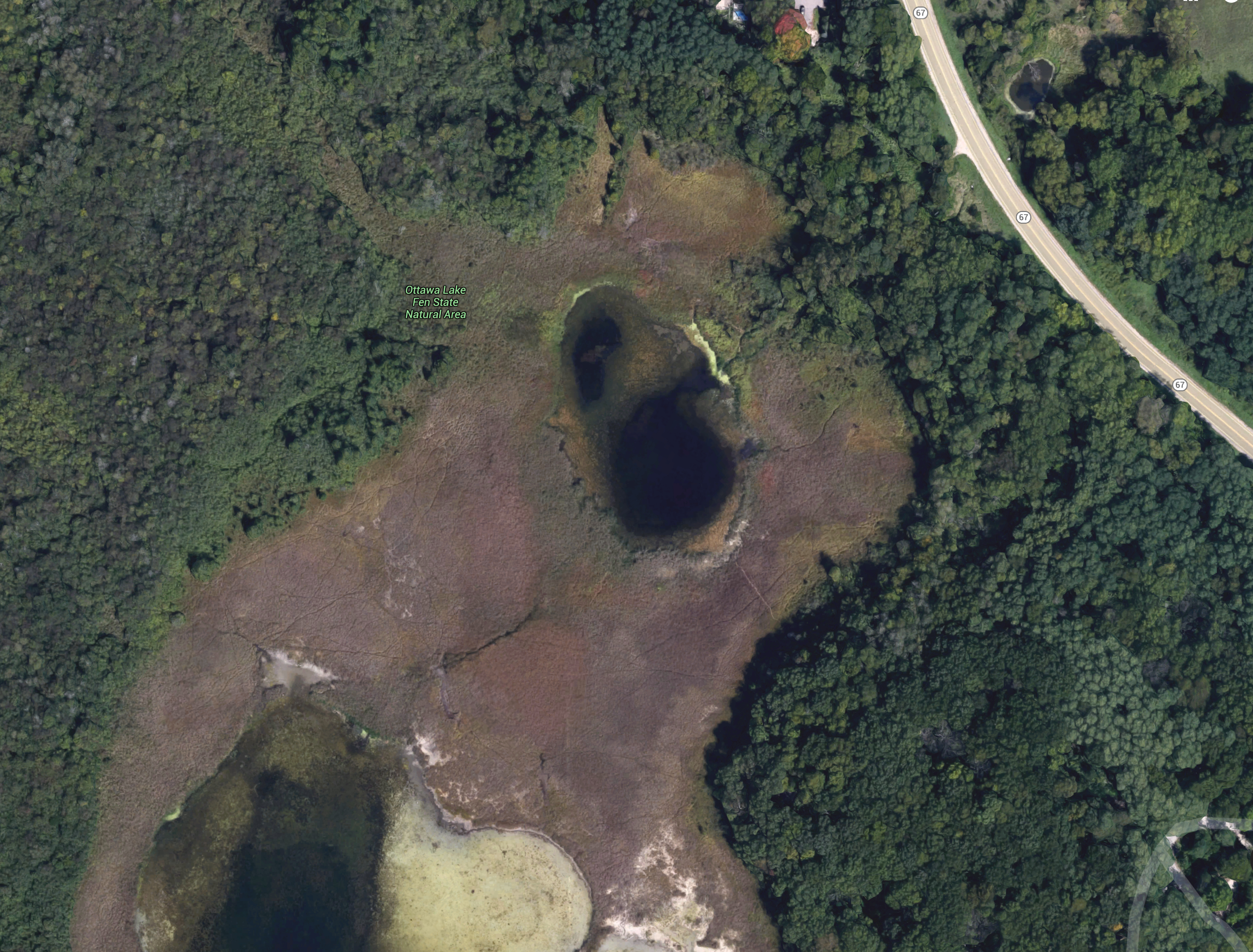
The Fen — 2013
Scroll a little north in the map above and drill into the Ottawa Lake Fen SNA. At the maximum zoom you can identify some of the drainage ditches identified above.
I began working on the oak studded hillside between the east shore of Ottawa Lake and the campground in the Fall of 2013, and eventually made it all the way around to Tamarack Bog on the northwest side of The Fen. Here is chronological timeline of The Buckthorn Man’s adventures at Ottawa Lake:
The Buckthorn Man’s right hand is almost healed from surgery for Dupuytren’s Contracture (no, not caused by cutting buckthorn) and he’s chomp’in at the bit to get back to work. The exciting news is that Eric Tarman-Ramcheck, who now works for the Wisconsin DNR has submitted a new North American Wetlands Conservation Act (NAWCA) grant request for the Ottawa Lake and Ottawa Lake Fen SNA areas. Here is a picture of the proposal.
Ben Johnson and Lindsay Knudsvig have joined The Buckthorn Man in making a commitment to work on the project to generate matching funds for the grant. We should know by early Spring 2016 whether or not the grant has been awarded. I hope you will see the value of working at the Ottawa Lake Fen State Natural Area with us — there is still a ton of work to do out there! Please visit the Volunteer page to learn more about how to volunteer with The Buckthorn Man and Contact me!
Tamarack Bog
Crossing The Fen
View from site #334
Sunset over The Fen
View from north side of Fen
Fen sunset
Buckthorn thicket “before”
Nothing like a buckthorn fire on a chilly night!
Before image
Ottawa Lake Sunsets
The Fen from site #334
Tamarack Bog
Ottawa Lake
The Fen
Ottawa Lake
Geo-Engineering The Fen
Winter Fen
Buckthorn thicket on east slope above Fen
Northeast side of Ottawa Lake
View to north from handicap cabin deck
View of Ottawa Lake from handicap cabin deck
Campsite views
Huge oak at south end of campground
Buckthorn surround huge oak
Huge oak cleared!
Campsite views opened up…
View from fishing pier near boat launch area
Spring feeding The Fen
Dr. Dan Carter
Yeah, I love sunsets…
The beach at Ottawa Lake
Spring feeding The Fen
Halloween pumpkin carving at Ottawa Lake campground
The what, why, where, who, when and how of The Hartland Marsh (also known as The Hartland Ice Age Marsh or The Ice Age Wetland of Hartland — but I prefer — The Marsh.)
All of the principles enumerated under the NATURAL RESOURCES PROTECTION objective can be embodied, to the everlasting benefit of the people Hartland, and the surrounding communities as well, by the wise realization of this goal at The Hartland Marsh:
Soils Principle
Lakes and Streams Principle
Groundwater Principle
Wetlands Principle
Woodlands Principle
Wildlife Principle
Natural Areas and Critical Species Habitats Principle
Environmental Corridor and Isolated Natural Resource Area Principle
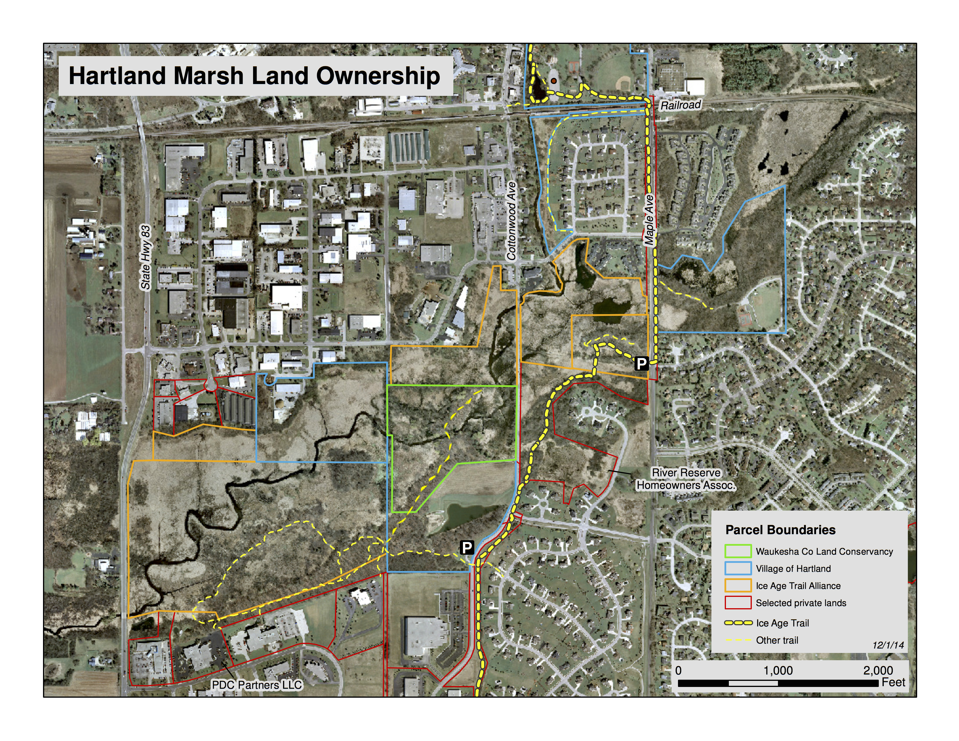
The Hartland Marsh is an approximately 200 acre area bordered by Maple Avenue on the east, Hwy 83 on the west, Cardinal Lane on the north and Walnut Ridge Drive on the south.
The environmental corridor extends west of Hwy 83 all the way to lake Nagawicki, east to Penbrook Park, and north following the Bark River Greenway. However, the primary focus of our work right now is between Maple Avenue and Hwy 83.
Who?
There are 4 land owners in The Hartland Marsh: The Village of Hartland, The Waukesha County Land Conservancy, The Ice Age Trail Alliance and private owners. The map below delineates the properties.
Anyone with the interest and energy can get involved on this project in cooperation with the existing owners. Heck, The Buckthorn Man lives in Milwaukee! Visit the Volunteer page at this site and Contact The Buckthorn Man to see how you can contribute.
When?
In 1991 the IAT trail began acquiring their properties shown on the map above by purchasing 80 acres from the Maslowski family. In 1998 the IAT purchased 10.6 acres from the Arrowhead Builders and 40.835 acres from Schneider-Peters.
In 1992 Marlin Johnson, who was teaching Biology at UW Waukesha at the time, and was an active member of the Waukesha/Milwaukee Chapter of the Ice Age Trail Alliance, presented a proposal for developing the IAT’s property. They had no public access at the time and had to cut through the parking area of PDC Facilities Inc. to get to the land. The plan called for the creation of a loop trail that included approximately 2,000 feet of boardwalk at a cost of roughly $20,000. The IAT chapter, under the leadership of Ken Neitzke, completed the boardwalk and trail in 1994.
In late 1999, Marlin formed The Friends of the Hartland Marsh and began leading the effort to clear the buckthorn from the John Muir Island and it was on one of his workdays in February 2000 that The Buckthorn Man first learned how to use a chainsaw (the little numbers on the map below represent springs and you can read all about them here.) Marlin succeeded in executing one prescribed burn on the John Muir Island with the Friends of the Hartland Marsh.
In 1999, former U.S. Congressman Henry Reuss, one of the founders of the Ice Age Trail, formulated the plan to make the Ice Age Wetland of Hartland a nature preserve open to the public. That initiative got the Village of Hartland involved and they developed the Cottonwood Wayside and parking area at the John Muir Overlook shown above. Henry visited the site in 2001, shortly before his death, for the dedication.
Meanwhile, The Buckthorn Man had been working at Brady’s Rocks and the Scuppernong Springs Nature Trail doing what he loved — freeing the glorious oak, cherry and hickory trees of the Kettle Moraine forest from the scourge of buckthorn.
At an IAT workday at The Marsh in 2005, The Buckthorn Man got the bright idea that he would tackle the buckthorn there. This quixotic endeavor inspired IAT veteran, John Mesching (who, by the way, learned how to use a chainsaw the same workday on the John Muir Island as I did) to remark: “You’ve found your life’s work”. You were right John! I spent the next 6 years working 1-2 days a week on average cutting, poisoning, piling and burning buckthorn at The Marsh.
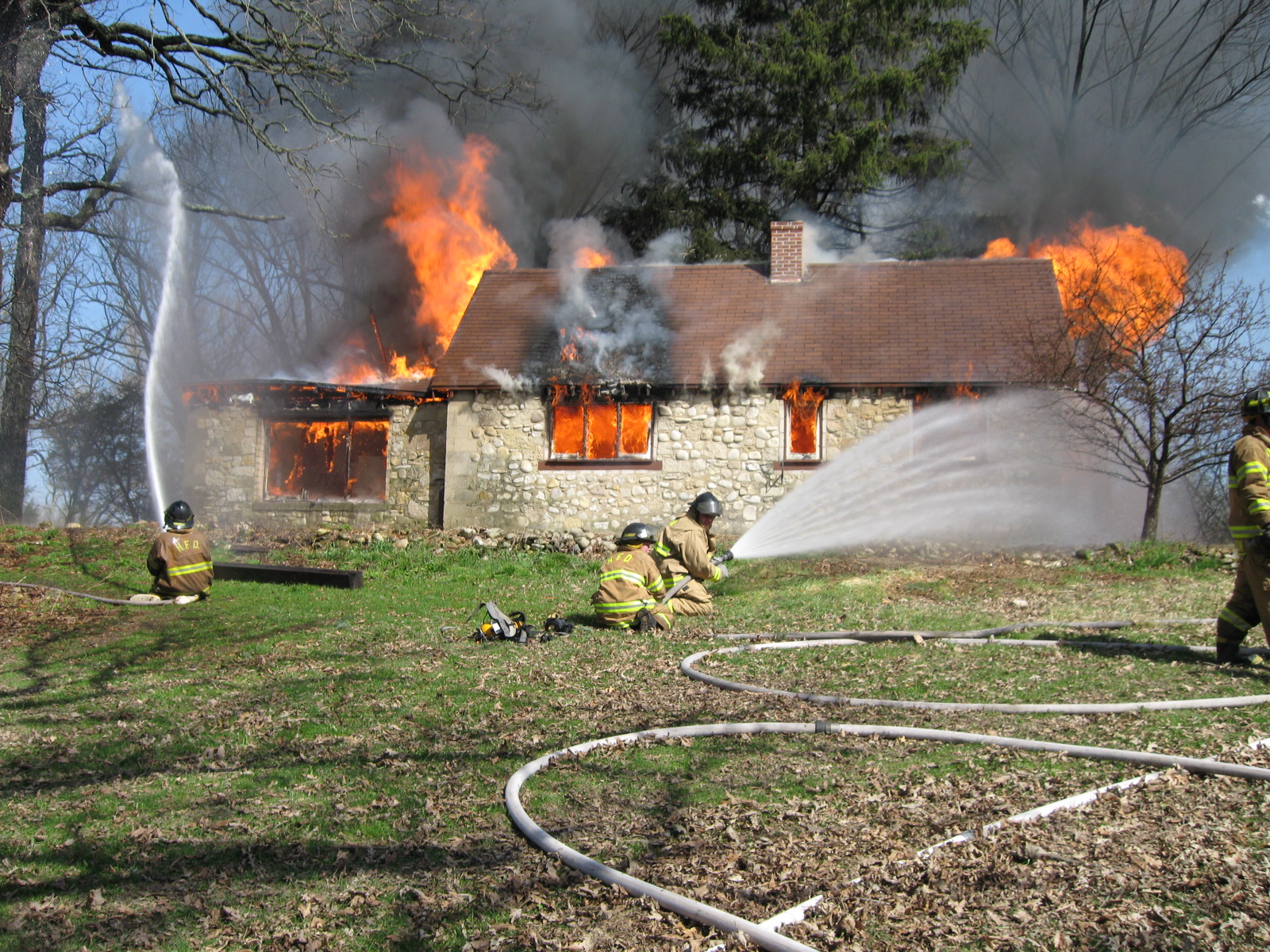
In 2007 Marlin Johnson, in his role on the board of the Waukesha County Land Conservancy, negotiated the purchase of the old Parker Brothers (and more recently, Minogue) 28 acre homestead on the Bark River immediately north of the Village of Hartland’s property. He asked Pati and I to become the caretakers of this land and we readily agreed. Check out this post for related stories and a great gallery of pictures that Pati took the day the Village of Hartland Fire Department burned the old homestead down.
I was making great progress on the project and I coordinated with Arrowhead High School teacher, Greg Bisbee for at least 2 workdays a year. The kids piled brush, pulled garlic mustard or gathered and sowed native grass and flower seeds. In June of 2010 the Village of Hartland honored me by declaring “Paul Mozina Day”!
But, alas, something was missing. Although I did get some help, it was pretty much a solo effort — I did not build a network of members from the community, support from the IAT waned, as they were very close to divesting themselves of this property in exchange for land that they needed for the trail corridor, and my incursions onto the private lands of the River Reserve subdivision — without first getting their permission — were not welcome. And lastly, there was no support for doing prescribed burns, which were essential to preserve the gains I had made cutting the existing buckthorn. As it was, I found myself chasing my tail trying to brush cut and poison with foliar spray all the thousands of buckthorn resprouts and seedlings that were proliferating in the newly opened areas. I was lacking the key tool needed for success — fire. The resistance to fire was so great that ultimately, the Village asked me to stop my work, leaving hundreds of brush piles. The IAT prevailed on me to stop as well, so I called it quits in May of 2011.
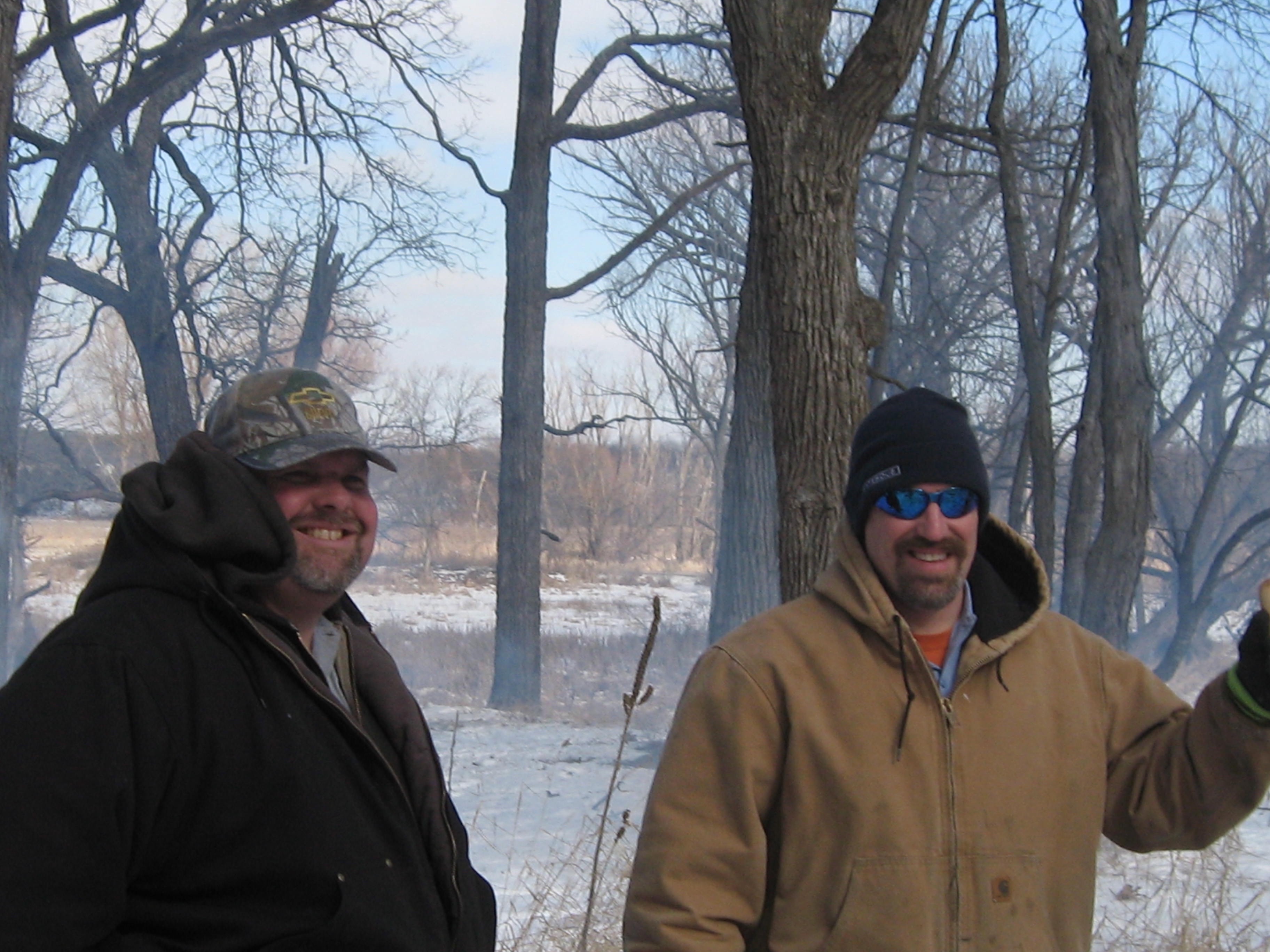
I returned to the Scuppernong Springs, where I had been working before I started at The Marsh, and threw myself into that effort. Meanwhile, the winds of change blew, and the Village of Hartland got a new Administrator, Dave Cox, who brought a new perspective and openness to the work we had been doing at The Marsh. In February 2013, I was invited back to The Marsh to burn the hundreds of brush piles I had left behind. My friends from the IAT were quick to pitch in and we were joined by the Village of Hartland maintenance crew.
I kept an eye on the rapid degradation of The Marsh since my departure — the buckthorn was coming back and destined to become a worse thicket than what I had encountered when I first started working there. For every mature buckthorn I had cut, there were dozens, hundreds, of new young buckthorn rapidly filling the voids. Still, I found the place enchantingly beautiful.
Construction workers from MSI General put the finishing touches on a new roosting site for Hartland’s chimney swifts. The advocacy groups associated with the project still need about $23,000 in donations to offset the cost of the chimney.
Yes, the winds of change were blowing “swiftly” through the village and I’ll never forget how stunned Pati and I were the day we saw the Chimney Swift tower for the first time. We were walking up the hill towards the Cottonwood Wayside (we had come from the Waukesha County Land Conservancy property) and had no idea that Village of Hartland community had come together to turn a dream into a reality.
The committee secured funds from the U.S. Fish and Wildlife Service and the Village of Hartland and hired Integrative Restoration, LLC, to write a proposal for The Marsh. We were fortunate to have the participation of Paul Sandgren, who was the Superintendent of the Southern Kettle Moraine Forest and Lapham Peak at the time, and he generously, on behalf of the DNR, donated the use of two of their forestry mowers and, their best team, to come out and do some clearing for us at The Marsh.
The recommended comprehensive plan for the Village of Hartland provides a design for the attainment of the specific development objectives set forth in Chapter 3, and at the end of each chapter. The plan is not complete, however, until the steps necessary to implement the plan are specified. After formal adoption of the comprehensive plan, realization of the plan will require faithful, long-term dedication to the underlying objectives by Village officials concerned with its implementation. Adoption of the plan is only the beginning of a series of actions necessary to achieve the planning objectives expressed in this report. More specifically, this chapter outlines the actions that should be taken by various agencies and units of government in efforts to implement the comprehensive development plan.
7. Protect and encourage the preservation of primary and secondary environmental corridors and isolated natural areas, and discourage residential development in environmentally sensitive areas, but provide for some marketability of such lands in order to allow economical use of lands suited to limited and controlled residential development. When permitting somewhat more intensive use of such lands without impacting the environmentally sensitive areas, it is recommended that cluster developments and conservancy subdivisions be required.
What specific steps are being implemented by the Village of Hartland to “Protect and encourage the preservation of primary and secondary environmental corridors…”? Is discouraging residential development enough? I have talked with Dave Lamerand, the President of the Village Board and David Cox, the Village Administrator, about increasing the financial commitment of the village by allocating resources to protect and preserve the primary and secondary environmental corridors from “the inside”. The biggest threat we are facing now is the internal degradation of these natural areas caused by invasive plants like buckthorn, honeysuckle and garlic mustard.
The village is actively participating in the initiative spearheaded by the IAT in the Fall of 2014 to restore The Marsh. They donated $2,500 to the effort in 2015. The U.S. Fish and Wildlife Service donated $5,000. Approximately half of these funds were spent in 2015 employing staff from Integrative Restorations, LLC to spray herbicide on the brush that the DNR cut in March and for other services. We are at a critical juncture if we want to efficiently preserve the hard work that The Buckthorn Man did from 2004 – 2011 clearing the mature buckthorn from the environmental corridor. Like the head of Medusa, for every mature buckthorn removed, dozens, if not hundreds of young seedlings and sprouted up to replace them.
We need a sustained financial commitment from the Village so that we can implement the restoration plan in a coherent, consistent and efficient manner. The main priorities right now are to hire forestry mowers to cut the buckthorn, while it is still relatively easy to do, and to hire professionals to conduct prescribed burns to prevent the buckthorn from taking hold again. Per the restoration plan prepared by Integrative Restorations, LLC, we need approximately $17,000 to $23,000 over the next three years to accomplish the goals on just the upland portions of the Hartland Marsh environmental corridor (tackling the wetlands would be in “phase II”.) While the Ice Age Trail Alliance and the Waukesha County Land Conservancy may be able to contribute additional funding through grant writing activity, we need the Village of Hartland to step up it’s financial commitment. I hope to make the case at a Village Board meeting in the near future.
A detailed water trail plan would not only help officially designate and delineate a Bark River Water Trail route, but it would also identify trail-related facilities that should be constructed and improvements that should be implemented to establish a safe and navigable trail corridor for both recreational and educational pursuits in an ecologically sensitive manner. The designation of an official water trail may further instill a sense of trail stewardship among canoeists/kayakers to respect the quality of the water and become good caretakers of the river.
Specific trail improvements and support facilities that should be identified on the plan may include providing parking facilities, restrooms, handicapped access, and picnicking areas; removing litter and fallen trees for navigability; installing wayfinding and educational signs; and improving underpasses or providing safe portaging areas with durable paths and crossing signs.
There is no doubt that this effort cannot succeed without a plan, so let’s make a plan and get after it. I will be lobbying the Village Board to prioritize this effort and partner with the Business Improvement District and the City of Delafield to make it happen.
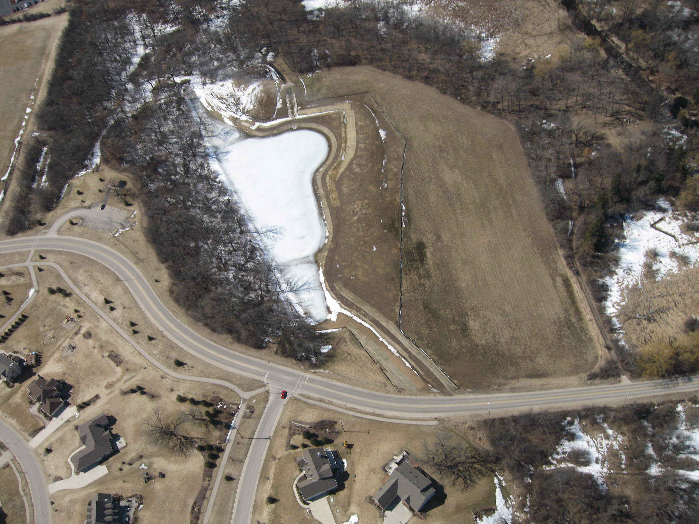
And, last but not least, I am suggesting that the village land immediately north of the detention pond (between the pond and the WCLC land) be converted from a corn/soy bean agricultural field into “The Hartland Prairie”.
“You may say, I’m a dreamer. But I’m not the only one.”, John Lennon
Wouldn’t it make more sense from the perspective of this area as part of the primary environmental corridor in the Village of Hartland, to convert it to a prairie instead? I think it could be done for $3,000 – $4,000. This is another thing I would like to discuss with the Village Board.
So, won’t you join me in this “Great Work”. Share these ideas with your friends, especially if they live in in the Village of Hartland. Visit the Volunteer page on this website and Contact The Buckthorn Man to find out more about how you can contribute to the success of this project.
Thanks! See you at The Marsh.
p.s. If you want to dig deeper into the history of The Marsh, check out Marlin Johnson’s work.
1/19/16 Pati and I visited Penbrook Park in the heart of the primary environmental corridor.