Who am I and why do I care?
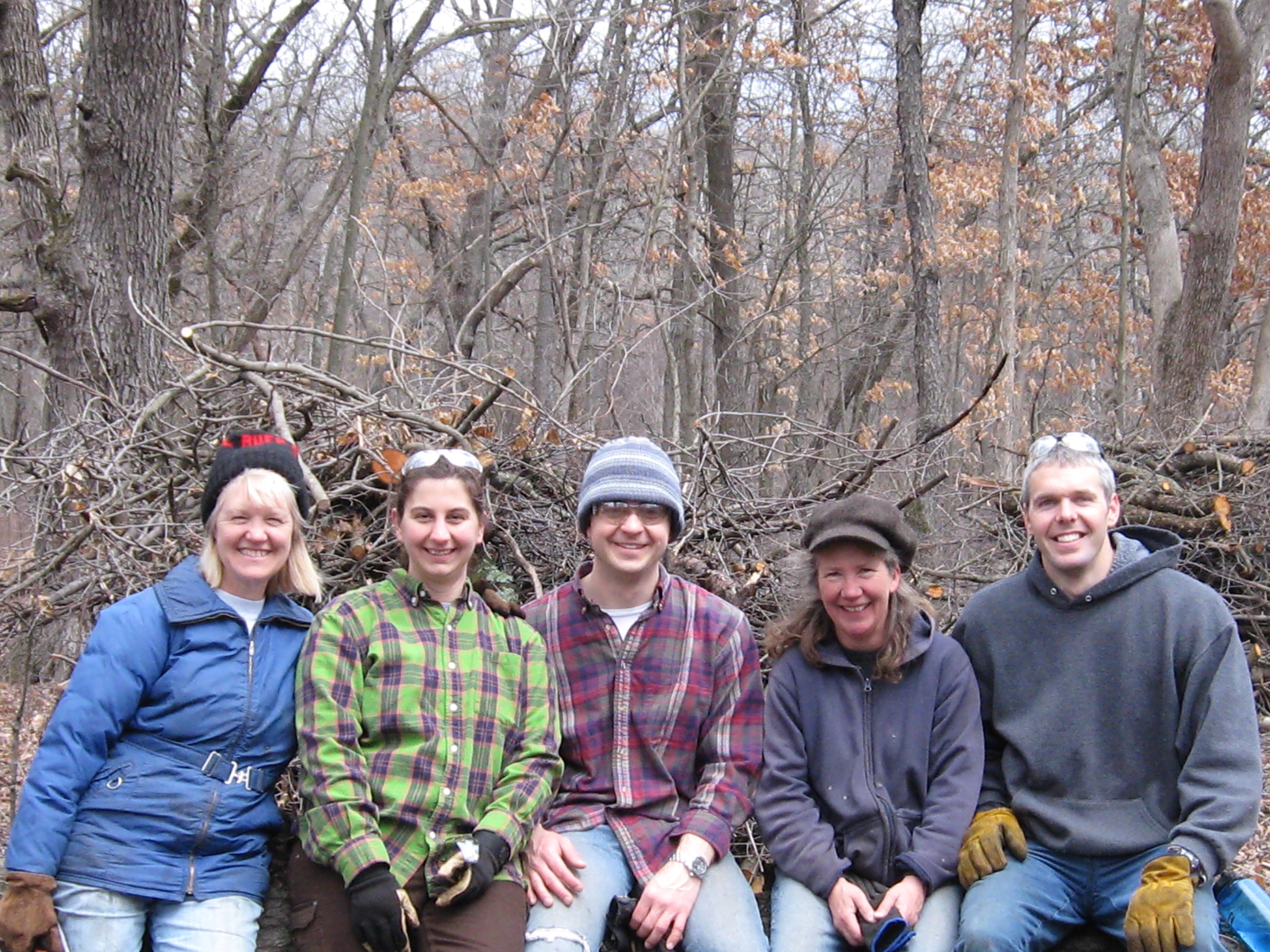
I retired from a 24 year career in Information Systems at Northwestern Mutual in February, 2012 to focus on ecosystem restoration. I began volunteering with the Waukesha/Milwaukee Chapter of the Ice Age Trail Alliance in 1997 and learned to cut buckthorn in 2000. I spent approximately 7 years volunteering at the Hartland Marsh spending thousands of hours and dollars fighting invasive species like buckthorn and garlic mustard. In June of 2010 the Village of Hartland honored me by declaring “Paul Mozina Day”. You can read more about the history of the Hartland Marsh restoration effort here.
What do residents of Hartland want?
When I would meet local residents on the trails at The Marsh, they would always be very supportive of the work I was doing. It wasn’t until I read the Village of Hartland Comprehensive Development Plan: 2035, hereafter referred to simply as The Plan, that I learned of the depth of that support.
The community survey results documented in Appendix B in The Plan lay the foundation for its objectives and principles.
- “Which items have the greatest positive influence on the quality of life in the Village?”: 57% said Parks and open Spaces, the highest percentage for any of the items listed (fire and police, water/sewer etc…).
- “The protection of woodlands, wetlands, floodlands, and other open spaces in and around the Village is important.”: 72% strongly agreed, 26% agreed.
- “Unless a productive use can be found for woodlands or other upland open spaces in and around the Village, they may as well be developed.”: 65% strongly disagreed, 27% disagreed
- “Greenspace requirements in the Village should be increased for all new multi-family, commercial, institutional and industrial development.”: 51% strongly agreed and 37% agreed.
- “A parkway and nature preserve along the Bark River should continue to be established through the Village.”: 51% strongly agreed and 42% agreed.
Chapter 3, Objectives, Principles and Standards of The Plan summarizes the community survey on page 3-16:
* A community survey indicated that most Village residents and business operators value its small- village character and precious natural resources. They prefer to grow somewhat larger in size but at a slower rate than the past few years; support single-family residential development and housing for the elderly but oppose new two- and multi-family residential development; support commercial development but not new industrial development; favored a Bark River greenway and additional parks, recreational facilities, and an interconnecting system of walkways, bikeways, and trails; and favored further improvements to the Village Center while establishing design standards for new intense urban developments.
That was then, this is now; where is the Village headed?
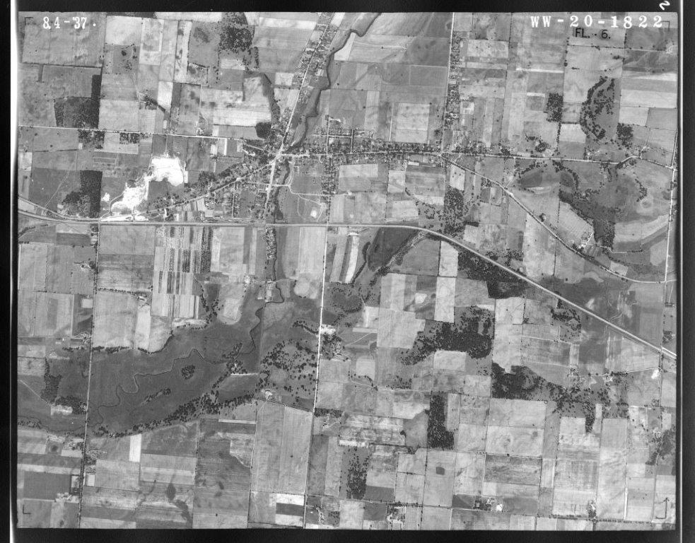
The Village of Hartland August 4, 1937
My friend, Martin Diffley, made a relevant and profound statement in Atina Diffley’s fantastic book, Turn Here Sweet Corn: Organic Farming Works:
“If we don’t change direction, we’re going to end up where we’ve been going.”
You can almost count the big trees in the primary environmental corridor on the picture above. Those were the days before the invasion of the weed trees like buckthorn. Let’s focus in more closely on four areas of interest within this environmental corridor:
- The Cottonwood Wayside aka, the John Muir Lookout — Village land
- The Waukesha County Land Conservancy property — formerly the Parker Brothers’ homestead
- The Aldo Leopold Lookout on the west side of Maple Ave — Ice Age Trail Alliance land
- Penbrook Park on the east side of Maple Avenue — Village land
The images are arranged in 4 galleries below and they range from 1941 to 2015. Click the first image in each gallery to open it and then follow the narrative description in the lower left corner of the gallery as you move from slide to slide.
The Cottonwood Wayside aka, the John Muir Lookout — Village land


The Waukesha County Land Conservancy property — formerly the Parker Brothers’ homestead


The Aldo Leopold Lookout on the west side of Maple Ave — Ice Age Trail Alliance Land


Penbrook Park on the east side of Maple Avenue — Village land


Please see my post Penbrook Park for a closer examination of the current status of the park.
Comprehensive Development Plan — Focus on Natural Resources Protection
The Plan page 1-5:
Formulation of Objectives, Principles, Standards, and Design Guidelines
The issues and opportunities described earlier created Objectives. An objective is a goal toward which the attainment of a plan is directed. The objectives serve as a guide to the preparation of alternative plans and provided an important basis for the evaluation of these alternatives and the selection of a recommended plan from among the alternatives considered. The Comprehensive Plan should be clearly related to the defined objectives through a set of principles, standards, and design guidelines. Objectives may change as new information is developed, as objectives are fulfilled through plan implementation, or as objectives fail to be implemented due to changing public attitudes and values. Because objectives are essentially reflections of the values held by residents of a planning area, the formulation of objectives should involve the active participation of Village officials and citizens. To this end, the results of a community survey and the Village Plan Commission, which includes both key elected and appointed local officials and citizen members, provided guidance throughout the entire planning process.
Chapter 3, Objectives, Principles and Standards of The Plan is, as you would expect, comprehensive regarding the planning requirements of the Village. My purpose here is to focus on the NATURAL RESOURCES PROTECTION objective.
OBJECTIVE NO. 1 – NATURAL RESOURCES PROTECTION
Encourage the protection and wise use of the natural resources and agricultural lands in the study area. The preservation of sufficient high-quality open space lands for protection of the underlying and sustaining natural resource base will enhance the social and economic well-being and environmental quality of the Hartland area.
Principle
The proper allocation of land uses can assist in maintaining an ecological balance between human activities and the natural environment. Such ecological balance and natural beauty are important determinants of a community’s ability to provide a pleasant and habitable environment for all forms of life. Preservation of the most significant aspects of the natural resource base, that is, primary environmental corridors and significant agricultural lands, further contributes to the maintenance of the ecological balance, natural beauty, and economic well-being of the Village and environs.
I refer you to Chapter 3 in The Plan to review the excellent explanations of the foundations for the Natural Resources Protection objective, which the wise residents of the Village overwhelmingly support.
- Soils Principle
- Lakes and Streams Principle
- Groundwater Principle
- Wetlands Principle
- Woodlands Principle
- Wildlife Principle
- Natural Areas and Critical Species Habitats Principle
- Environmental Corridor and Isolated Natural Resource Area Principle
Chapter 4 Agricultural, Natural, and Cultural Resources of The Plan, includes additional descriptions and practical considerations of the implications of the principles listed above. Here are a few highlights:
WATER RESOURCES
Surface water resources such as lakes and streams and their associated floodplains, form a particularly important element of the natural resource base of the Village of Hartland study area. The contribution of these resources, including groundwater, is immeasurable to the economic development, recreational activity, and aesthetic quality of the Hartland area.
WETLANDS
Wetlands, however, have important recreational and ecological values. Wetlands contribute to flood control and water quality enhancement, since such areas naturally serve to store excess runoff temporarily, thereby tending to reduce peak flows and to trap sediments, undesirable nutrients, and other water pollutants. Wetlands may also serve as groundwater recharge and discharge areas. Additional important natural functions of wetlands include the provision of breeding, nesting, resting, and feeding grounds and predator escape cover for many forms of wildlife. In view of these important functions, continued efforts should be made to protect these areas by discouraging wetland draining, filling, and urbanization.
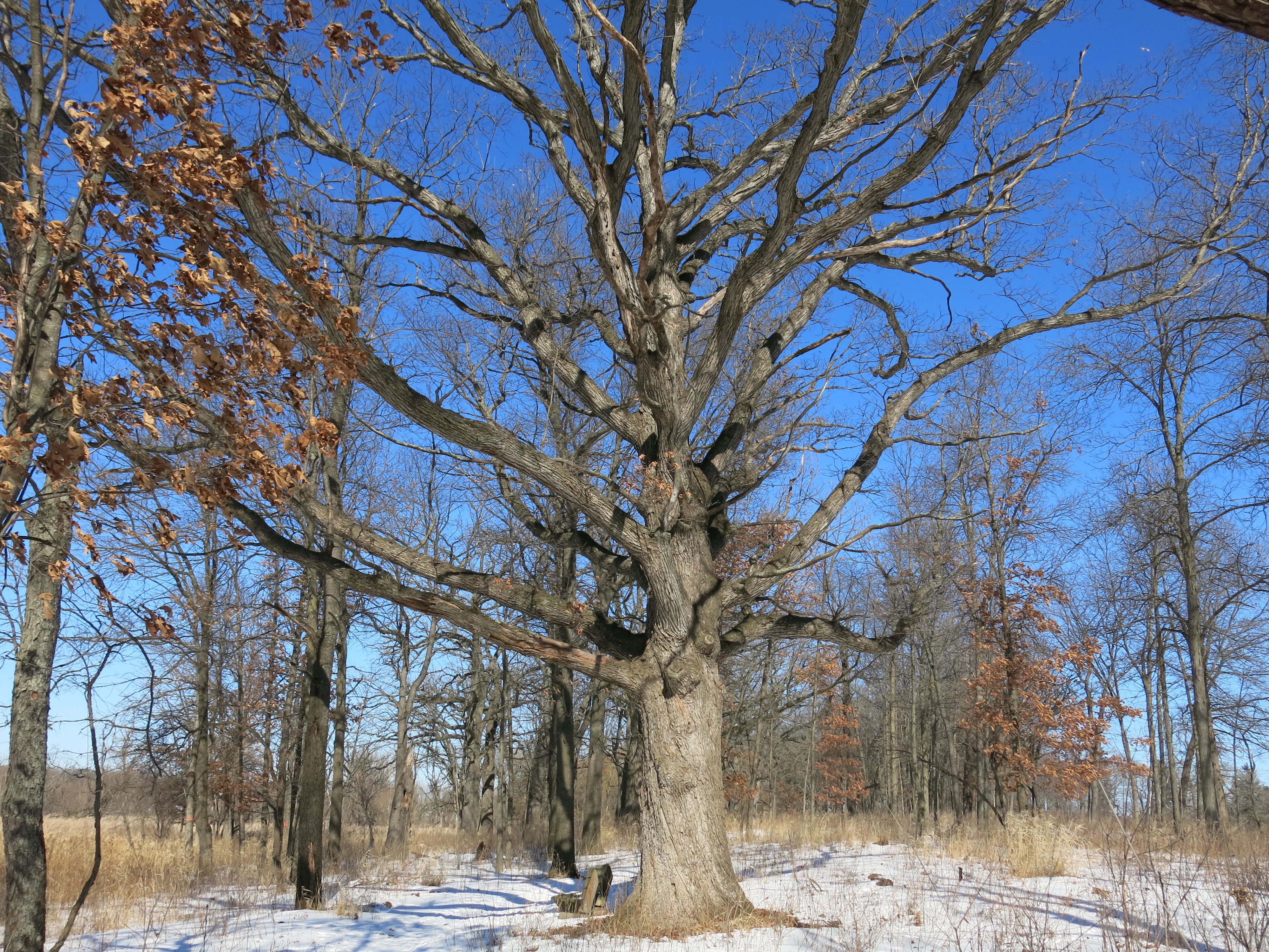
WOODLANDS
Under good management, woodlands can serve a variety of beneficial functions. In addition to contributing to clean air and water and regulating surface water runoff, the woodlands contribute to the maintenance of a diversity of plant and animal life. Unfortunately, woodlands which required a century or more to develop can be destroyed through mismanagement in a comparatively short time. The destruction of woodlands, particularly on hillsides, can contribute to increased stormwater runoff and soil erosion, the siltation of lakes and streams, and the destruction of wildlife habitat. Woodlands should be maintained for their scenic, wildlife habitat, open space, educational, recreational, and air and water quality protection values.
WILDLIFE HABITATS
Wildlife in the Village of Hartland study area include species such as rabbit, squirrel, woodchuck, raccoon, fox, whitetail deer, pheasant, and water fowl. The remaining wildlife habitat areas provide valuable recreation opportunities and constitute an invaluable aesthetic asset to the study area. The spectrum of wildlife species has, along with the habitat, undergone tremendous alterations since settlement by Europeans and the subsequent clearing of forests and draining of wetlands for agricultural purposes and urban development.
ENVIRONMENTAL CORRIDORS AND ISOLATED NATURAL RESOURCE AREAS
These areas are identified and mapped so that they can be maintained in their natural state. The essentially linear corridors represent a composite of the best remaining elements of the natural resource base in the study area, and have immeasurable environmental and recreational value. Preservation of the primary environmental corridors, and careful consideration of preserving secondary environmental corridors and isolated natural resource areas, in an essentially open, natural state – including compatible park and open space uses and rural-density residential uses – will serve to maintain a high level of environmental quality in the area, protect the natural beauty of the area, and provide valuable recreation opportunities.
Standards 1. All remaining undeveloped lands within designated primary environmental corridors should be preserved in essentially natural, open use.
Chapter 1, page 1-9 of The Plan describes the tools the Village may employ to achieve the plan objectives:
Implementation of the adopted plan requires the use of several planning tools of a legal nature. A Village zoning ordinance and accompanying zoning district map should be used to legally assure that private development and redevelopment will occur in conformance with the adopted plan.
In the Village of Hartland Ordinances Chapter 46 — Zoning, we see the following regulations codified:
DIVISION 24. – C-1 LOWLAND CONSERVANCY DISTRICT
(a)
The C-1 lowland conservancy district is intended to preserve, protect and enhance the ponds, streams and wetland areas of the village. The preservation, protection and enhancement of these areas will serve to maintain safe and healthful conditions; maintain and improve water quality, both groundwater and surface water; prevent flood damage; control stormwater runoff; protect stream banks from erosion; protect groundwater recharge and discharge areas; protect wildlife habitat; protect native plant communities; avoid the location of structures on soils which are generally not suitable for such use; and protect the water-based recreation resources of the village.
DIVISION 28. – UCO UPLAND CONSERVANCY OVERLAY DISTRICT
(a)
The UCO upland conservancy overlay district is intended to preserve, protect, enhance and restore all significant woodlands, wildlife habitat areas, areas of rough topography and related scenic areas. Regulation of these areas will serve to control erosion and sedimentation and will promote and maintain the natural beauty of the village, while not interfering with development rights perceived by the village board and assigned by the underlying basic district.
On page 9-9 of the Land Use Plans and Regulations chapter of The Plan it says:
Particularly pertinent to updating the Land Use plan for the Village of Hartland are the recommendations for the protection of primary environmental corridors and agricultural lands of the Region, and for the encouragement of a more compact pattern of urban development.
Chapter 10 Implementation and Intergovernmental Cooperation includes:
The recommended comprehensive plan for the Village of Hartland provides a design for the attainment of the specific development objectives set forth in Chapter 3, and at the end of each chapter. The plan is not complete, however, until the steps necessary to implement the plan are specified. After formal adoption of the comprehensive plan, realization of the plan will require faithful, long-term dedication to the underlying objectives by Village officials concerned with its implementation. Adoption of the plan is only the beginning of a series of actions necessary to achieve the planning objectives expressed in this report. More specifically, this chapter outlines the actions that should be taken by various agencies and units of government in efforts to implement the comprehensive development plan.
AGRICULTURAL, NATURAL, AND CULTURAL – IMPLEMENTATION RECOMMENDATIONS
7. Protect and encourage the preservation of primary and secondary environmental corridors and isolated natural areas, and discourage residential development in environmentally sensitive areas, but provide for some marketability of such lands in order to allow economical use of lands suited to limited and controlled residential development. When permitting somewhat more intensive use of such lands without impacting the environmentally sensitive areas, it is recommended that cluster developments and conservancy subdivisions be required.
PLAN RE-EVALUATION
A comprehensive plan is intended to serve as a guide for decision-making regarding development and redevelopment in a community. As a practical matter, local comprehensive plans should be prepared for a long- range planning period, typically about 20-25 years. The design year chosen as a basis for the preparation of the Village of Hartland comprehensive plan is 2035. A comprehensive plan should be evaluated regularly to ensure that it continues to reflect local development conditions and planning objectives. In general, it is recommended that this re-evaluation take place every 10 years, or more frequently if warranted by changing conditions. The Village has decided to re-evaluate the entire plan in 2015 and every 5 years thereafter, and to do an annual review in November to determine if changes are needed to comply with changing conditions or the State of Wisconsin Comprehensive Planning requirements as explained below.
What about The Plan?
Looking at The Plan, one cannot help but be impressed by its breath and scope, the history and chain of events leading up to it, and the enormous amount of care and effort that has gone into its preparation. Given its comprehensive nature, it may seem unfair of me to zero in on one area of The Plan, but I feel a sense of urgency and respectfully call the attention of the Village Board to the following questions and concerns:
- Was The entire Plan re-evaluated in 2015? If yes, were the results published? If not, why not and when is the next re-evaluation of The entire Plan scheduled?
- Has an annual review ever been done? If yes, were the results published? If not, when will the next annual review of The Plan be conducted and will the results be published?
- How is the health of the primary environmental corridor evaluated? What criteria will be used for the Lowland and Upland Conservancies as part of the re-evaluation process? What benchmark data will be referenced?
- What department in the Village is responsible for managing the primary environmental corridor on lands owned by the Village and lands owned privately?
- There is no mention of primary environmental corridor preservation or protection in the narrative for the 2016 DPW budget. Does the Village view the primary environmental corridor as a Capital Asset worthy of consideration for the Capital Improvements Budget (consider Village land and Privately owned land). If not, why not?
- What management activities does the village engage in on portions of land it owns, that are not parks and that are part of the environmental corridor (lowland and upland conservancies) e.g., the Village lands adjoining the Cottonwood Wayside (search Tax Key HAV 0757003002)?
- What management activities does the village engage in on Park land that surrounds or adjoins the developed recreational facilities at the Park e.g., the environmental corridor (lowland and upland conservancies) west and north of the developed facilities at Penbrook Park (search Tax Key HAV 0727998001)?
- How many cents/day do you think residents would be willing to pay to see the Village actively and effectively managing the environmental corridors within the Village?
- On Map 18, dated 1998 in, A Master Plan for the Village of Hartland: 2020, SEWRPC refers to the area immediately north of the detention pond on Cottonwood Ave as “Agricultural and other open lands”, while the 2009 Smart Growth Plan Map shows the same area as a Conservancy Park and the 2012 Zoning Map shows it as a Park and Recreation Area. The Comprehensive Outdoor Recreation Plan 2013 – 2017 defines Conservancy Area on page 11: “Conservancy areas or natural resource areas are lands set aside to preserve significant natural resources, remnant landscapes, or open space. They may also be used to provide buffering between residential and more intensive land uses. Aside from habitat preservation and visual aesthetics, uses within these areas are generally limited to activities such as hiking trails and wildlife viewing”. Is the current usage of this property for agriculture and composting consistent with its classification, in more recent documents, as a Conservancy Park or Recreation Park?
- In 2014 the Village gave public notice of an order to cut or destroy noxious weeds. Is the Village still actively enforcing this order, and if so, does it apply to Village owned land in the lowland and upland conservancies that are part of the environmental corridor?
- Appendix D of The Plan — Invasive Plants — provides a list of invasive plants of concern and recommends: “If these plants are already located in existing natural areas, it is recommended that they be removed to protect native vegetation, provided that wholesale clearing in the absence of a detailed restoration plan does not result in problems related to bare ground and erosion.” Considering that The Plan calls for the preservation and protection of the environmental corridor in a natural state, and that, by definition, an area overrun with invasive species is not in a natural state, does the Village plan to take any action on this recommendation either on Village or Private lands?
- Park trees are surveyed and maintained as valuable assets, what value does the Village place on mature oak, hickory and cherry trees on Village land that is not delineated specifically as a Park e.g., the Village lands adjoining Cottonwood Wayside?
- The Village is planning to survey the Park trees in 2016, would you consider also surveying the trees in the lowland and upland conservancies that are not in officially designated Parks?
- Does the Park tree survey include the entire area of Penbrook Park including the lowland and upland conservancies?
- Will the survey consider the impact of undesirable trees in the parks and make recommendations as to the cost effectiveness of removing the undesirable trees as a way of reducing the maintenance and replanting expenses for the desirable trees?
Recommendations
Thank you for taking the time to review this presentation! I conclude with the following recommendations and hope you will seriously consider them. I look forward to meeting with you again soon to continue discussing The Plan.
- Create specific plans with actionable items funded via annual budget allocations for the preservation and protection of the environmental corridors in the Village.
- Designate a department within the Village administration that is accountable for the preservation and protection of the environmental corridors in the Village.
- Establish a program to provide resources, training and support for private land owners to get rid of the invasive species on their properties, especially those that contain or abut portions of the environmental corridor.
- Coordinate volunteer workdays on Village lands (parks, greenways, upland and lowland conservancies etc…) to remove invasive species.
- Develop benchmark data and publish criteria that the Village will use to evaluate the health of the environmental corridor to determine compliance with the desires of the community survey respondents and subsequently expressed in the objectives of The Plan.
- Inventory the invasive species that are present on Village and Private lands in the environmental corridor and determine their impact now and in the future.
- Survey the network of abandoned drainage ditches that crisscross the wetlands in the environmental corridor to determine if plugging/filling them would increase the retention of surface water and aid in the recharge of the aquifers the Village relies on.
- Convert the agriculture and compost field north of the detention pond on Cottonwood Avenue into the Hartland Prairie.
- Update the Municipal Code Sec. 46-784. – Tree cutting and shrubbery clearing to make an exception for invasive trees and shrubs.
- Allocate Capital Improvement funds to build seasonal restroom facilities at the Cottonwood Wayside and begin renting this site for private parties with the revenue specifically earmarked for environmental corridor preservation and protection.
- The Village of Hartland 2014 Financial statements state on page 3 that: “The Village of Hartland is a progressive community with a commitment to maintaining assets through an aggressive capital projects program.” The Village should begin treating its environmental corridors and natural habitat areas as capital assets and explicitly budget for their maintenance.
- The Village reported a $9,425,677 unrestricted net position in the Village of Hartland 2014 Financial statements (page 3), and that 22% of the governmental fund balance ($1,758,297) is available for discretionary spending. Use a portion of these funds for environmental corridor restoration and preservation and to develop a program to accomplish the same with private property owners.
Conclusion
The preservation, restoration and protection of the primary environmental corridor in the Village of Hartland is too vitally important to leave in the hands of ad hoc groups of volunteers, especially when considering that the Village is one of the primary land owners in the corridor. It is time for the Village to create actionable plans with reliable funding and management infrastructure to implement the goals and objectives for Natural Resources Protection that were unanimously voted for in the community surveys and clearly enumerated in the 8 principles listed above. Consider that once an area is recovered the costs of maintaining it are relatively low.
“If we don’t change direction, we’re going to end up where we’ve been going.” Martin Diffley
